LDS Site for Winter Quarters Temple
LDS Site for Winter Quarters Visitor Center
Mormon History
• Mormon Trail Center
• Fairbanks Sculpture
• Handcarts Sculpture
• Mormon Bridge
• Mormon Ferry
• Mormon Bridge Tollbooth
• Mormon Bridge Marker
• Mormon Bridge Marker at Bank
• Mormon Cemetery
• Mormon Cemetery Marker
• Cutler Park Marker
• First Night Camp Marker
• Mormon Park Marker

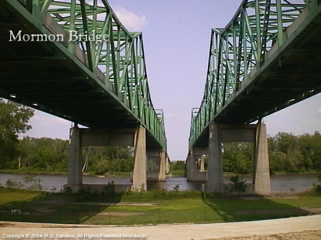
Mormon Bridge

Located at Interstate 680 and the Missouri River or where I-680 would intersect with John J. Pershing Drive (9290 John J. Pershing Drive (Google Maps and Satellite maps logo)) GPS: 41.3455524 -95.9572358 (GeoHack logo) or 412044N 0955726W

Image - Mormon Bridge
Mormon Bridge from west side of Missouri River

Aerial View of Bridge

The Mormon Bridge is built over the Missouri River in the same location as the historic Mormon Ferry (known as the second ferry).  Florence's history is centered on this location.  Due to the Mormon Ferry being built here, it was learned that this location along the Missouri has the unique feature of having a rock bottom, which was the basis for why the same area was chosen to build Florence.  The idea being that where there was a rock bottom in the Missouri River would be an ideal place to build the bridge that would allow the transcontinental railroad to cross, and thereby influencing the growth of the community on the Nebraska side of the river.

The Mormon Bridge was constructed starting in 1952, and was built to be paid with tolls.  If you have ever had to pay tolls for anything, you know that they never seem to get paid off; in the case of the Mormon Bridge, it did get paid off on April 21, 1979.  As a result, the toll booth was no longer necessary.
German Flag Symbol Portuguese Flag Symbol Italian Flag Symbol Spanish Flag Symbol French Flag Symbol


Use the browser back arrow or use your backspace to return to the previous page, or click on the following links. ()
•  Back  |  Top  |  Home  |  Omaha  |  Sports  |  Information Links
Omaha Neighbors  |  Bellevue  |  Council Bluffs  |  Florence  |  Lincoln  |  Kansas City
European Explorers  |  Native American Period  |  Mormon Period  |  Omaha History  |  Bellevue History
Nebraska Intro  |  Nebraska History  |  Nebraska Waters  |  Nebraska Birds
Nebraska Communities (Miles from Omaha)  |  Nebraska Communities (A-Z)  |  Nebraska Chamber of Commerce Links
Neighbor States  |  Iowa  |  Missouri  |  Kansas  |  Colorado  |  Wyoming  |  South Dakota
Advertise  |  About  |  Contact  |  Help  |  Link To Us  |  Site Map  |  Site Info  |  Copyright |  Disclaimer |  Privacy |  Terms
• External Link Pages: Attractions  |  Entertainment  |  Recreation  |  Restaurants  |  Shopping  |  Education  |  History
• External Link Pages: Omaha Links  |  Old Market Links  |  Douglas County Links  |  Nebraska Links  |  United States Links •

Problems viewing the web pages due to small print?

Entire website last checked for invalid links September 1, 2023, 12:00:00 EDT
Saturday, November 23rd, 2024, 4:31 P.M. - Last modified: November 5th, 2024 at 16:17:07.
Intellectual Technology portions copyright 1996–2024 - GCS.
Content Portions Copyright 1996–2024, All About Omaha, Inc., Omaha, Nebraska and GCS. 1996–2024, GCS, Jacksonville, FL • Send e-mail
.

Footer Menu is being added.

 
.
.
Load time: 0.358 seconds